Created: 2018
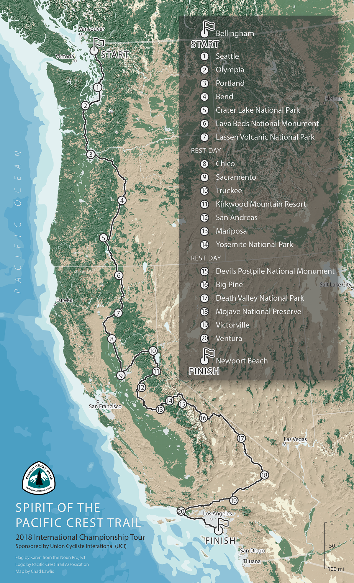
About: Static map created for "Graphic Design in Cartography" class as part of UW-Madison's M.S. in Cartography, GIS, and Web Map Programming. Prompted to plot a route for a twenty-one-stage cycling race, anywhere in the world, with each stage covering approximately 100 miles (less if accounting for steep terrain) and a rest day every seven stages. The route must overlay custom terrain representation (shaded relief with land cover) developed from raw digital elevation and land cover data. I chose to plot the route along portions of the Pacific Crest Trail, intended to resemble but not precisely duplicate it (thus the "spirit" of the Pacific Crest Trail).
Process: Route plotted with Google My Maps. 15" Digitial Elevation Model (DEM) mosaic created with GDAL. Shaded relief (generalized and exaggerated) and land cover (generalized) processed with ArcGIS. Terrain representation (blending shaded relief with land cover) processed with Photoshop (special thanks to Daniel Huffman's tutorial). All other map data processed with GDAL/OGR, QGIS, and ArcGIS. Final design with Illustrator.
Click to enlarge image.